


Photo Record
Images
Metadata
Title |
1-11 Vendue Range / North Atlantic Wharf Building / Union Pier |
Date |
1924-1925 |
Description |
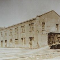
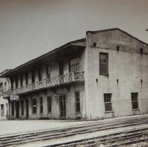
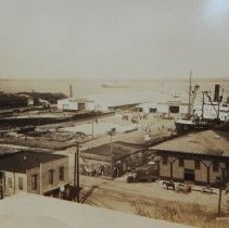
Three photographs (scans of originals): a: View of the commercial buildings that had been located at 1-11 Vendue Range, southeast elevation, ca. 1924. Railroad car in foreground. b: View of a building on North Atlantic Wharf located by the railroad tracks. Identified as The E.S.T. Co. Offices on the 1902 Sanborn Map. Now the site of the City Gallery. Dated June 4, 1924. c: Aerial view of Union Pier buildings, looking east, showing two Utilities Commission buildings, the dock, and other unidentified buildings on Concord Street (foreground). Dated April 3, 1925. |
Object Type |
Photograph |
Photographer/Creator |
Unattributed |
Subjects |
Commercial buildings--South Carolina--Charleston Historic buildings--South Carolina--Charleston Lost architecture--South Carolina--Charleston Union Pier Terminal (Charleston, S.C.) |
Search Terms |
Vendue Range Demolished buildings, lost buildings Atlantic Wharf/Mid-Atlantic Wharf/Middle Atlantic Wharf |
Classification |
Lost Architecture |
Copyright |
Public domain. |
Object ID # |
2019.011.2a-c |