Photos
4078 results found sorted by relevance. Records searched: 4078
-
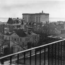
Aerial View of Charleston Buildings After Hurricane Hugo - 1989
Aerial view of Charleston buildings after Hurricane Hugo, looking south. Landmarks include 1 King Street (f/k/a Fort Sumter Hotel), 20 South Battery, and 32 South Battery cupola. B&W photograph. Two prints in sleeve.
Record Type: Photo
-
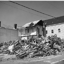
138 Broad Street After Hurricane Hugo - 1989
B&W photograph of 138 Broad Street after Hurricane Hugo. Two prints in sleeve.
Record Type: Photo
-
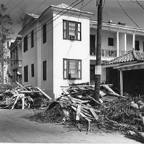
132 Smith Street After Hurricane Hugo - 1989
Two B&W photographs of 132 Smith Street after Hurricane Hugo. a: Smith Street elevation. Debris in foreground. b: Vanderhorst Street elevation of 132 Smith Street. Neighboring houses also in view (68 Vanderhorst and 64 Vanderhorst). Debris on street in front of buildings.
Record Type: Photo
-
136 St. Philip Street / 138 St. Philip Street / 140 St. Philip Street After Hurricane Hugo - 1989
B&W photograph of the 130 block of St. Philip Street after Hurricane Hugo. Shows 136 St. Philip Street (left), 138 St. Philip Street (center), and 140 St. Philip Street (right).
Record Type: Photo
-
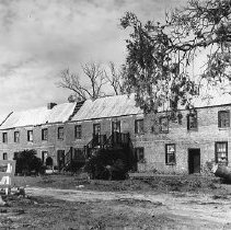
Boone Hall Plantation Gin House After Hurricane Hugo - 1989
Two B&W photographs of the Boone Hall Plantation Cotton Gin House after Hurricane Hugo.
Record Type: Photo
-
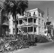
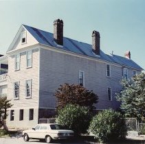
East Side Homes After Hurricane Hugo - 1989
B&W photograph of East Side homes after Hurricane Hugo. (Need to confirm location.)
Record Type: Photo
-
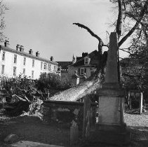
Church Graveyard After Hurricane Hugo - 1989
B&W photograph of a church graveyard after Hurricane Hugo.
Record Type: Photo
-
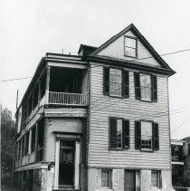
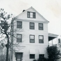
6 Judith Street (John Robinson Tenement) Before Rehabilitation - ca. 1974
B&W photograph of 6 Judith Street (John Robinson Tenement) before rehabilitation: a: South (front) elevation. b: Corner view, south (front) and west (piazzas) elevations. c: Corner view, south (front) and east elevations. d: Rear elevation of house, west elevation of outbuilding. e: West elevation of outbuilding.
Record Type: Photo
-
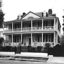
6 Judith Street (John Robinson Tenement) After Rehabilitation - ca. 1980
Color photograph of 6 Judith Street (John Robinson Tenement) after rehabilitation, corner view showing the south (front) and east elevations.
Record Type: Photo
-
10 Judith Street (John Robinson House) - 1978
B&W photograph of 10 Judith Street (John Robinson House), north (street) elevation.
Record Type: Photo
-
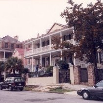
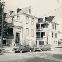
10 Judith Street, 12 Judith Street, 48 Elizabeth Street - ca. 1990s?
Color photograph of a view looking west on Judith Street showing 10 Judith Street (John Robinson House) (foreground), 12 Judith Street (middle), and the Aiken-Rhett House (48 Elizabeth Street) (background).
Record Type: Photo
-
15 Judith Street (John Robinson House) - ca. 1980
B&W photograph of 15 Judith Street (John Robinson House), north (front) elevation.
Record Type: Photo
-
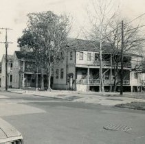
View on Judith Street (4-8 Judith) - ca. 1980
B&W photograph of a view east on Judith Street from 8 to 4 Judith Street. Features 8 Judith and 6 Judith. Cars parked on street.
Record Type: Photo
-
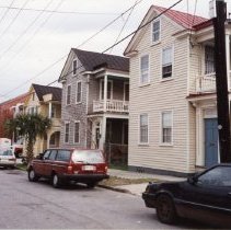
3-7 Judith Street - 1980s?
Color photograph of 3-7 Judith Street taken at different orientations. Shows (left to right) 3 Judith, 5 Judith, and 7 Judith.
Record Type: Photo
-
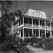
East on Judith Street from 9 Judith - ca. 1980
B&W photograph of a view looking east on Judith Street from 9 Judith (before rehabilitation), showing its north (front) and west (piazzas) elevations. Also shows (left to right) 3 Judith, 5 Judith, and 7 Judith.
Record Type: Photo