Photos
4078 results found sorted by relevance. Records searched: 4078
-
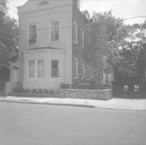
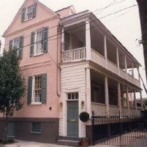
The "Original" 11 George Street - 1960s
B&W photograph of house that was originally numbered 11 George Street, corner view, north (front) and west (piazzas) elevations. It had been located two lots to the west of the current 11 George (where a 15 George would be located if it existed). This house and the house directly its east -- the original 9 George -- were demolished for the construction of a parking lot.
Record Type: Photo
-
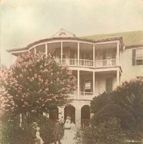
6 Gibbes Street (Parker-Drayton House) and Louis Manigault - 1870
Photogaph of the Parker-Drayton House (6 Gibbes Street), a/k/a Drayton-Manigault House, ca. 1870. In foreground, Louis Manigault (seated) and daughter Josephine and son Louis (with hoop). On porch is LM's sister Emma holding infant Charles, next to the nurse and "yard-servant boy." Faintly in background is Harriet (sister of the author of the description). Scan of an original photograph.
Record Type: Photo
-
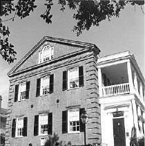
6 Glebe Street (St. Philip's Parsonage House) - ca. 1995
B&W photograph of the St. Philip's Parsonage House (6 Glebe Street), south elevation featuring the steps leading to the entry door. Garden area in foreground.
Record Type: Photo
-
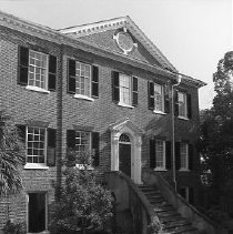
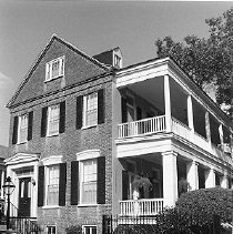
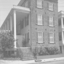
12 Glebe Street (William Harral House) - ca. 1996
B&W photograph of the William Harral House (12 Glebe Street), corner view of the house, showing the east (front) and north (piazzas) elevations.
Record Type: Photo
-
20 Glebe Street (Thompson-Muller House) - ca. 1995
B&W photograph of the Thompson-Muller House (20 Glebe Street), east (front) elevation.)
Record Type: Photo
-
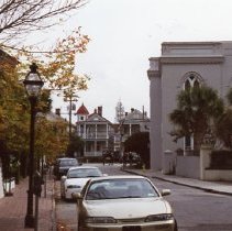
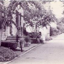
View of Glebe Street - 2000
Two color photographs of Glebe Street, looking south toward Wentworth Street, taken at slightly different orientations. 12 Glebe Street is in the left foreground; a portion of the northeast elevation of Hanahan Hall (Grace Episcopal Church) is at the center (left); and 101 Wentworth-103 Wentworth are in background (center). December 2000 written on back. Photo B not scanned.
Record Type: Photo
-
14 Green Street (Knox-Lesesne House) - 1996
B&W photograph of the Knox-Lesesne House (14 Green Street), front elevation.
Record Type: Photo
-
29 Hasell Street, Exterior and Interior Photographs - Undated
Fifteen color photographs of 29 Hasell Street, five photos of the exterior and ten photos of interior rooms (living room, bedrooms, dining room). Photos B, D, E, L, and M featured in this record.
Record Type: Photo
-
-
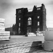
Bennett Rice Mill After Hurricane Hugo - 1989
B&W photograph of the remaining facade of the Bennett Rice Mill after Hurricane Hugo.
Record Type: Photo
-
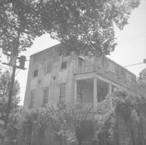
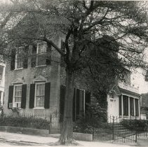
37 Hasell Street (Jones-Howell House) - 1960s
B&W photograph of 37 Hasell Street (Jones-Howell House), corner view of house showing the north (front) and west (piazzas) elevations. "ARP" [Ansonborough Rehabilitation Project] handwritten on back of photo.
Record Type: Photo
-
40 Hasell Street - 1960
B&W photograph of 40 Hasell Street, corner view of house showing the south (front) and west (portico) elevations. "ARP" [Ansonborough Rehabilitation Project] handwritten on back of photo.
Record Type: Photo
-
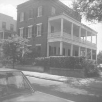
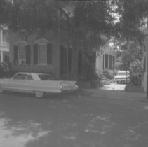
41 Hasell Street - 1960
B&W photograph of 41 Hasell Street, corner view of house showing the north (street) and west (entrance) elevations. View is partially obscured by trees. Car parked on street in front of house. "ARP" [Ansonborough Rehabilitation Project] handwritten on back of photo.
Record Type: Photo
-
41 Hasell Street - 1965
Two B&W photographs of 41 Hasell Street: a: Corner view of house showing the north (street) and west (entrance) elevations. b: View from one room into another, through an opening flanked by columns and topped by an architrave.
Record Type: Photo
-
43 Hasell Street - 1960
B&W photograph of 43 Hasell Street, corner view of the house showing the north (front) and west (entrance) elevations. "ARP" [Ansonborough Rehabilitation Project] handwritten on back of photo.
Record Type: Photo