Photos
4078 results found sorted by relevance. Records searched: 4078
-
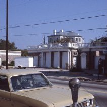
288-290 Meeting Street - 1980s
Four Ektachrome color slides of the gas station located at 288-290 Meeting Street shortly before its demolition. It had been constructed on the site of the Gabriel Manigault House which itself was demolished in the 1920s. Brick and other elements (columns, balusters, and window surrounds) were saved from the demolition and used in the HCF's Frances R. Edmunds Center for Historic Preservation at 108 Meeting Street. a: View from across the stree...
Record Type: Photo
-
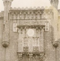
"Old Citadel" [337 Meeting Street] - 1963
Seven Polaroid photographs of the "Old Citadel": a: Portion of the entry, south elevation. b: Archway over an alley(?) between two buildings. Sign posted at right: "Don't Blow Horn. Stop." c-e: Views of the courtyard. Photo C dated February 1963. f-g: Views of the east wing arched entry with iron balcony above. Photo F dated February 1963.
Record Type: Photo
-
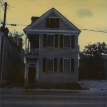
497 Meeting Street After Being Partially Burned - 1984
Three color Polaroid photographs of 497 Meeting Street taken soon after it was partially burned in a fire in September 1984.
Record Type: Photo
-
9 Mid-Atlantic Wharf (Carolina Shipping Co. Building) - Jan. 2001
B&W photographs of 9 Mid-Atlantic Wharf (Carolina Shipping Co. Building). Various views. 11 photos in sleeve.
Record Type: Photo
-
8 Montagu (Sarah Campbell House) - ca. 1996
B&W photograph of 8 Montagu (Sarah Campbell House). Street elevation, corner view.
Record Type: Photo
-
12 Montagu Street (McNeill-Egan House) 12 Montagu Street (McNeill-Egan House) - 1979?
Two B&W photographs of 12 Montagu Street (McNeill-Egan House). A: View of piazzas. B: Doorway.
Record Type: Photo
-
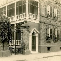
43 Legare Street (Charles Elliott House) - ca. 1920
Photograph of the first two stories of the Charles Elliott House (43 Legare Street), corner view featuring the east (front) and south (piazzas) elevations.
Record Type: Photo
-
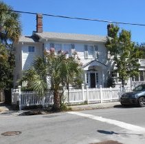
46 Lenwood Boulevard - 2015
Twenty-five color digital photographs of 46 Lenwood Boulevard. Various exterior and interior views. Photographs taken in September, 2015. Sample shown in this record.
Record Type: Photo
-
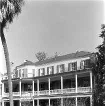
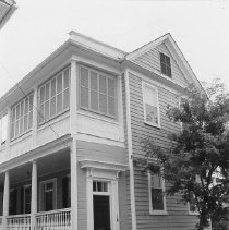
3 Limehouse Street - ca. 1996
Two B&W photographs of 3 Limehouse Street, both corner views of the house showing the east (front) and south (piazzas) elevations, at different orientations. Photo B not scanned.
Record Type: Photo
-
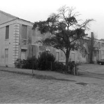
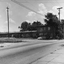
Photographic Documentation of 44 Line Street - 1976-1977
Sixteen B&W photographs documenting the condition of 44 Line Street (South Carolina Railroad Car Shop). a: Exterior view, west elevation. Captioned "Building at 44 Line Street...May 31, 1976." b: Exterior view. c: Exterior view. Captioned "Small house at east rear of building, originally thought to be part of 44 Line St. property, but later found not. Destroyed by owner in early 1978. Picture 5/31/76." d: Exterior view. Captioned "Par...
Record Type: Photo
-
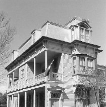
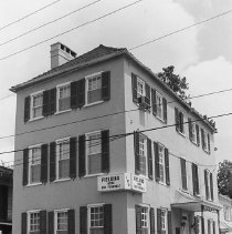
Matthias Wolfe House (122 Logan Street) - ca. 1996
Two B&W photographs of the Matthias Wolfe House (122 Logan Street): a: Fielding Home for Funerals, corner view showing the west and south (main entry) elevations. b: Fielding Home for Funerals, west elevation. Constructed 1790-1800; rehabilitated 1980s. A well-to-do butcher built this three-story, stuccoed brick single house with a hipped, pantile roof in the late 18th century. The structure retains its original form with some intact win...
Record Type: Photo
-
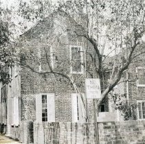
28 Longitude Lane - 1950s
Polaroid photograph of 28 Longitude Lane showing the south and east elevations. "No Thru Street" sign in foreground. Written on back: "Mrs. Austin Igleheart, Jr., Evansville, Ind." Assumed to be the owner or resident at the time.
Record Type: Photo
-
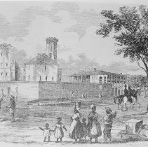
Scene at the Corner of Magazine and Franklin Streets - mid-19th c. (est. date of original)
Photographic reprint of a lithograph featuring a scene at the corner of Magazine and Franklin Streets, showing a small group of enslaved Africans (women, men, children) in the foreground and white men on horseback. The Old City Jail and the Old Marine Hospital are in the background. Original source and date of illustration not indicated.
Record Type: Photo
-
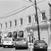
36-38 North Market Street (J.C.H. Claussen Range) - ca. 1996
Three views of 36-38 North Market Street (J.C.H. Claussen Range), south elevation.
Record Type: Photo
-
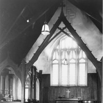
Interior of the Old Church of the Redeemer - Undated
Reprint of a photograph of the interior of the Old Church of the Redeemer (34 North Market Street). Original photograph in the Charleston Museum Archives.
Record Type: Photo