Photos
4078 results found sorted by relevance. Records searched: 4078
-
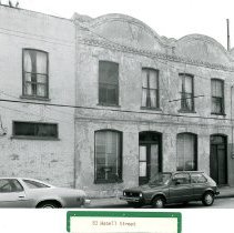
30 Hasell Street - 1960s
B&W photograph of 30 Hasell Street, corner view showing the south (front) and west (piazzas) elevations. "ARP" [Ansonborough Rehabilitation Project] written on back of photo.
Record Type: Photo
-
31 Hasell Street - 1960
B&W photograph of 31 Hasell Street, corner view showing the north (front) and west (piazzas) elevations. "ARP" [Ansonborough Rehabilitation Project] written on back of photo.
Record Type: Photo
-
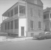
36 Hasell Street - 1960
B&W photograph of 36 Hasell Street, corner view of house showing south (front) and west (piazzas) elevations. Car parked on street in front of house. "ARP" [Ansonborough Rehabilitation Project] handwritten on back of photo.
Record Type: Photo
-
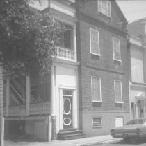
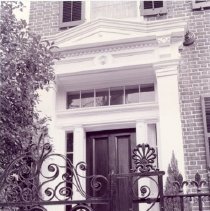
Doorway, 37 Hasell Street (Jones-Howell House) - ca. 1996
B&W photograph of the front door of 37 Hasell Street (Jones-Howell House), viewed through its iron gate.
Record Type: Photo
-
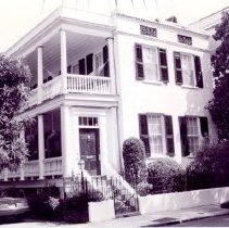
44 Hasell Street (James Stocker House) - ca. 1996
B&W photograph of 44 Hasell Street (James Stocker House), corner view of the house showing the south (front) and west (piazzas) elevations. Two copies of photo in sleeve.
Record Type: Photo
-
52 Hasell Street (Gibbons-Gilliland House) - ca. 1996
Two B&W photographs of 52 Hasell Street (Gibbons-Gilliland House): a: South (front) elevation. View partially obscured by tree. b: Entrance steps and doorway.
Record Type: Photo
-
47 Hasell Street - 1960
B&W photograph of 47 Hasell Street, corner view of house showing the north (front) and west (piazzas) elevations. "ARP" [Ansonborough Rehabilitation Project] handwritten on back of photo.
Record Type: Photo
-
53 Hasell Street - 1970s?
B&W photograph of 53 Hasell Street, north (front) elevation. Man and woman are walking in front of the house.
Record Type: Photo
-
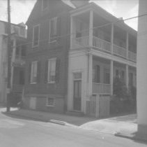
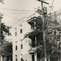
57 Hasell Street - 1960s
B&W photograph of 57 Hasell Street, north (front) and west elevations, corner view of building. ARP [Ansonborough Rehabilitation Project] handwritten on back of photo.
Record Type: Photo
-
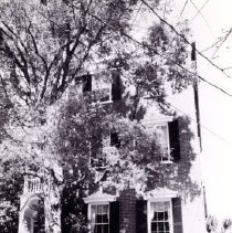
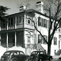
54 Hasell Street (Col. William Rhett House) - ca. 1940s
B&W photograph of 54 Hasell Street (Col. William Rhett House), south (front) elevation, showing the southwest corner of building. Cars parked on street in front of the house.
Record Type: Photo
-
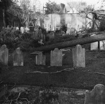
Church Graveyard After Hurricane Hugo - 1989
B&W photograph of a church graveyard after Hurricane Hugo.
Record Type: Photo
-
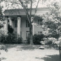
George Reynolds House (60 Hasell Street) - 1960s
Two B&W photographs of the George Reynolds House (60 Hasell Street): a: South (front) elevation. b: East elevation of the flanking building to the west of the main house. ARP [Ansonborough Rehabilitation Project] handwritten on back of photos.
Record Type: Photo
-
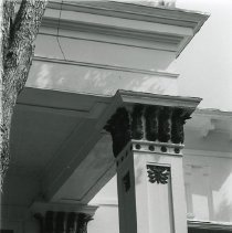
George Reynolds House (60 Hasell Street) - ca. 1995?
B&W photograph of the square columns of the George Reynolds House portico (60 Hasell Street).
Record Type: Photo
-
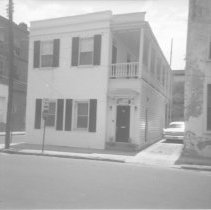
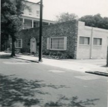
83 Hasell Street - 1970s
B&W photograph of 83 Hasell Street, street (front) elevation, connected to the north elevation of 235 Meeting Street. (Site adjacent to the Hasell Street entrance to Charleston Place.) Cars parked in front of buildings. *Chas. Center Photo."
Record Type: Photo
-
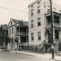
Hasell Street Looking East from 35 Hasell Street [29-35 Hasell Street] - ca. 1970
B&W photograph of Hasell Street houses, looking east from 35 Hasell to 29 Hasell. Features (L to R) 29 Hasell, 31 Hasell, 33 Hasell, and 35 Hasell.
Record Type: Photo