


Archive Record
Images
Metadata
Object Type |
Map |
Title |
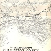
General Highway Map, Charleston County, South Carolina |
Scope & Content |
General Highway Map, Charleston County, South Carolina. Prepared by the South Carolina State Highway Department in cooperation with the U.S. Department of Transportation, Federal Highway Administration, Bureau of Public Roads. Polyconic projection compiled from controlled aerial photographs and rural road inventory. Plane coordinates South Carolina. South zone in thousands of feet. Cities and Towns, Cultural Features, Drainage, Boundaries, Road Systems, Road Types, Structures, Railroads, Airways, Misc Symbols, Misc Structures, and Recreational indicated by symbols; see legend. County Population 1970 Census -247,650 County Area in Square Miles- 945 Map showing location of Charleston County boundaries in South Carolina. |
Date |
1969 |
Subjects |
Charleston County (S.C.)--Maps |
Search Terms |
Park maps/highway maps |
Physical Description |
1 map, 44" x 18" |
Object ID # |
2008.001.3 |